Friday, May 29, 2009

Flattop Mountain

Joe left yesterday evening. It was a gray and dreary day in Anchorage, and so it only made it sadder to see him go. But he made it back to Oklahoma today, so all is well.

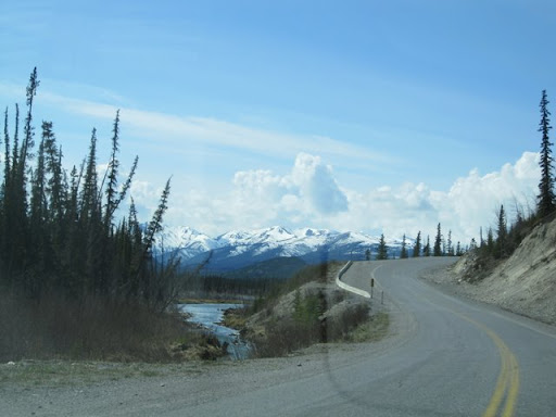
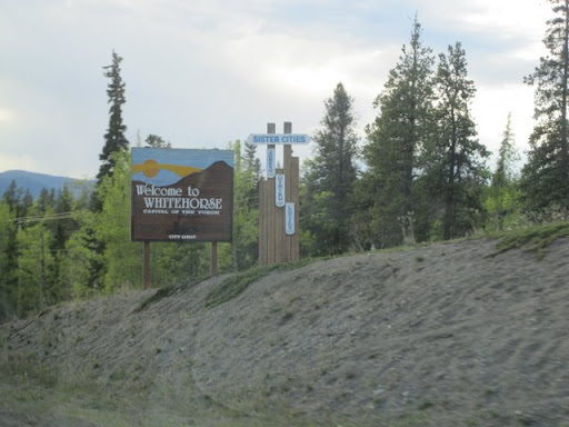
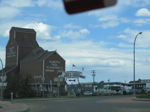
Today began all gray and gloomy again. In fact, the forecast is calling for it to stay gray and drizzly for the next five days, at least. However, I was sitting in the forecast office this afternoon, doing my work, and lo and behold the sun came out. And stayed out. And started coming out everywhere. As one of the forecasters put it, "You know, you look at the moisture advection and you're almost certain there will be clouds all day. Then a little hole develops in the clouds. And before you know it, that little hole is a bigger hole. And then...the entire Cook Inlet is one big hole in the clouds...". Needless to say, as I got off work today at 4, I was determined to take advantage of this pleasant weather, particularly with the ominous five-day forecast I had been looking at all day.

I decided that I really wanted to climb a mountain. Naturally, when I move to a city that is right next to a major mountain range, I want to take advantage of this new "thing" sitting next to me. The majority of the Chugach Mountains immediately east of Anchorage (they call this area the "Front Range". Not to be confused with the Colorado Front Range...) are in Chugach State Park, and there are dozens of trails back there. The only one I could find that actually claimed it went up a mountain was a trail that went to the top of Flattop Mountain (Which is very appropriately named when you look at it). It is "easily accessible from Anchorage" and therefore the "most climbed mountain in the state". It even has a Wikipedia page here. For me who comes from Illinois and Oklahoma (not particularly known for their mountains), I figured this would be a pleasant little hike and not pose much of a problem. So, immediately after work got out, I stopped at the store, bought a backpack, a few water bottles and a box of granola bars (it was so stereotypical that the girl who checked me out said, "I only need one guess to know what you're doing this afternoon...") and drove out to the trailhead.

Got to the Glen Alps trailhead at about 4:30. There were some 25 other cars there so there were other people around. The daily parking fee there was $5, so not bad at all. I strapped on my backpack (it's been years since I've worn a backpack) and set out at a brisk pace down the trail.

Flattop Mountain is only some 3500 feet tall and you're already halfway up when you actually get to the trailhead in your car, so it's even less that than. Laterally, the trail itself is only around 3 miles long, so that doesn't sound bad either. I started up the well-marked gravel trail going through the trees up the hill. Five minutes later I had to stop and was huffing and puffing and weak feeling and...wow. In the meantime, several other climbers kept passing me going the other way, just casually walking down with their dogs or families of small children, completely nonchalantly. I, of course, desperately tried to hide my gasping and heaving and say "Hello!" as if nothing was the matter. Here I was five minutes in, and already I was feeling completely spent. But I pushed on.

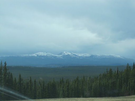
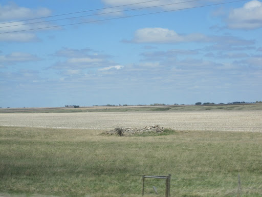
Five minutes later, I had to stop again. By this time I had reached a trail junction with an informational sign, so now when people passed me I could just act like I was intently reading the sign and so it looked perfectly natural for me to stop. The trail has four stages--the short first part I had just come up through some low pine trees, this next stretch where the path splits into a loop around a tall hill, a third stretch on the far side of this hill where the trail follows a ridge through the saddle point between that hill and the actual peak of the mountain, and the last leg which is the final ascent to the peak. Ok. So I continued down the trail, being very thankful for every level or slightly downhill stretch their was. How were people bringing their dogs or their very young children down this trail? It just amazed me. But every person who passed me re-srengthened my resolve to keep on going. The trail was well-marked and gravel, followed the hillside around the top of that hill and all the while giving spectacular sweeping views of the city of Anchorage below and the Cook Inlet beyond. I started seeing my frequent breaks as being well-worth it, just so I could stop and look around. A few times I actually sat down on a nearby rock (gulping down my water) and just looked around. I was well above the treeline by this point, and there was no interruption to the view. At least, until someone came by, still as easy-breathing and nonchalantly as ever, and I became embarrassed for sitting there and got up and moved on.

Finally I arrived at the other side of the hill and got to the turn off for the next leg. There was a sign here that read, "This section of trail rated: MODERATE. Adult supervision of small children and pets is highly recommended." After debating how small children or pets would have gotten up here without parental supervision, I looked up at the hike to come. "Moderate" to me implied "worse than it has been so far". Ugh. But the summit looked deceptively close. That's the funny thing about looking at mountains, at least for me. Whenever I see them, it just looks so easy to get through them or to climb them. Oh, just go up...not that hard. Distances seem a lot less from mountain to mountain than they actually are. Heights are distorted to seem smaller and closer than in reality. I decided to let myself be deceived this time, though, which gave me the confidence to press on.

This section of the trail winds up a ridge connecting the hill I had just come around with the main summit. Far from being easy, this section is so steep at points that the trail builders put in steps. Hundreds of them. It is the most disheartening thing ever to see this toddler hopping down the steps toward you, saying, "...one hundred twenty...one hundred twenty-one...one hundred twenty-two...". That much more to go. I started taking ten steps at a time then pausing to catch my breath. I'm sure we could ascribe some of this to my not being used to the air at that altitude or whatnot, but it really just boils down to my being out of shape. Which I am. Something I might try to change this summer. Anyhow, looking up towards the summit, I could see brightly-colored objects moving around, so I knew there were people up there. So I kept pressing on.

Finally, after what seemed like an eternity, I reached the end of the third leg. There was an elderly couple stopped there who were from England. Both of them had these ski-pole-looking things they were using to help keep themselves steady. It was somewhat interesting watching them trying to use those poles. Anyhow, at the immediate beginning of the final leg, there is a sudden, sharp upclimb of about 20 feet that was completely covered in snow. Slipperiest, sliding-est sort of thing I ever tried to climb. A sign followed that read, "This section of trail rated: DIFFICULT. Young children and pets not recommended." So I sat down and thought long and hard. And then thought even harder. I almost turned back. But then something in me said I couldn't turn back then (and all of that sitting and thinking had given me a decent amount of rest). So I moved on.

The trail then winds back and forth of the very steep slope in a series of switchbacks. Partway up I got a phone call from my parents (I somehow had cell phone service up there...) and took that call very happily since it gave me a break. While still mostly gravel, there were some small sections where you had to scramble over rocks. This slowed me down a bit, but that ended up being a good thing. I am someone, and I think many people are like this, who focuses a lot on the destination and not so much about the journey to the destination. I realize this is a very cliche sort of observation, but still... As such, I often try to get to that destination as quickly as possible, because the destination is all that matters. I was really pushing myself up this trail, because I had to get to the top of that mountain. Sure, the views were nice, but I had to get to the top. So I forced myself on.

However, as I got up the trail further, suddenly there was a point where the gravel disappeared into a steep slope of boulders and other large rocks. I had no idea where the trail was. Part of me thought, "Yes! Trail has ended. Can't go any further. I'm done." But then I noticed up a ways there was a rock where someone had spray-painted a large green dot. And further on there was another rock with a large green dot on it. So I figured that that was now the "trail" and began following the green dots. This started involving some climbing. Actual climbing. You had to scramble over rocks and, as the trail progressed, scramble UP the rocks to keep going. I've done some rock climbing, but this was just amazing. I got slowed way down, but that was perfect. It became a matter of going green dot to green dot. And that's all I had to do. I'm a problem-solving sort of person. There's nothing I enjoy more than developing a plan to solve some dilemma, then putting that plan into action to see how it works. And that's all this was. I get to a green dot. Stop. Look around (in EVERY direction, I learned...) and find the next green dot. Then, figure out what way I want to go over or around the rocks to get to that green dot. Find hand and foot holds and then do what I can to get there. After a few seconds, I'm there. Then repeat the entire process. The hike became so much fun. No hard breathing or feeling fatigued or anything like that. I was going slowly and solving these puzzles. So much for this section being "difficult". It was just a different kind of difficult. A kind I could deal with. The final bit of the trail was very steep going right up to the summit. A lot of vertical climbing.


Then, suddenly...I was there. On the relatively flat top of Flattop Mountain. Not another person in sight. It was so quiet...no wind, nothing. I walked around a bit on the top, taking pictures. Then, suddenly, out of nowhere, this other climber was up there heading towards me (I literally for a few seconds in my mind thought it was going to be Josh King, but it wasn't...) and he asked if I wanted my photo taken up there with my camera. So I said "sure" and got my photo taken up there, which was very nice. After he left, I wandered around for a few more minutes and enjoyed this. I had made it to the top. All of that effort, and I had made it to the top. How many times there were that I wanted to turn back and I made it to the top. Every green dot of the way.

Then I had to head down. Which, for the first part of the descent, proved far more harrowing than going up as I had to let myself down on these boulders while still following the dots. But I managed to get down there. And then as I descended down the stairs and everything, it's all downhill so it didn't take much effort. And I was able to casually walk down the hill, nonchalantly. Then I noticed I started passing a whole lot of people heading up. And these people were heaving and huffing and panting and looking like they were about to collapse. So I nonchalantly walked by, saying "Hello" and breathing easy.

Tuesday, May 26, 2009

Port Alcan

Well, as my last post indicated, we have made it to Alaska. I am now settled into our apartment on the campus of the University of Alaska--Anchorage and have begun my work at the Weather Forecast Office here in town. But first, a recap.

Pictures aren't ready yet, but as soon as they are available I'll share a few with you. Our story picks up where I last left off. Joe and I left Whitehorse, Yukon Territory at 7 in the morning on Monday. What followed were 5 hours of the most desolate highway we had seen yet. There are VERY few towns...only two or three between Haines Junction an hour out of Whitehorse and Beaver Creek by the Alaska-Canada Border. The road winds up between the Kluane and Dawson ranges of mountains on this stretch. We were in pure taiga land, with all coniferous forests and (according to our guidebook) areas of permafrost underground. The centerpiece of this leg of the drive was the great Kluane Lake, the largest lake in the Yukon Territory. The road follows a narrow strip between the Kluane Mountains and the lake. There were two towns--Destruction Bay and Burwash Landing--both on the lake. These, along with Haines Junction, were the only towns on this stretch. Calling them towns is also a stretch--most were a small collection of buildings with a gas station and a "closed for the season" lodge or RV park. From the lake, the highway continues to wind westward, approaching the Alaskan border. There are numerous frost heaves, where freezing and melting have caused severe dips and buckles in the pavement. This required some very attentive driving and several gut-swooping moments during the drive.

After gassing up in Beaver Creek, another 15 miles or so down the road was the Alaska-Canada border at Port Alcan. We stopped and took several pictures on the actual border, which is marked by a swath of trees that have been blasted out in a line stretching north to south along the border. The US Customs station was right after that, and the man there let us through in just a minute or so. No being searched or any ordeal like we had when coming into Canada. Of course, it looked like this guy may have been the only guy working that day, and we are way out in the middle of nowhere. Maybe these all contributed to the ease of our crossing. But anyhow, with nothing to hide, we were let through and got into Alaska. Clocks were set back an hour. I am now 3 hours behind Central Time (in case you were wondering).

Wow! What a difference that border crossing makes! For such an arbitrary border line, there is a drastic difference between the American and Canadian sides of the border. In Alaska, the highway moves away from the mountains (though the Saint Elias Mountains are still quite scenic and visible on the southern horizon) and into this vast open plain, filled with forests of pine and deciduous trees. Whereas it seemed like the trees had become all coniferous in the Yukon with any deciduous trees having no leaves, here the trees were all fully leafed out and it was beautiful. The road stays on the north side of the plain, riding along a hillside of a low ridge of hills to the north. It felt like a nice Sunday drive in Wisconsin or something through the woods. Even though it was still another 90 miles to the city of Tok, it didn't feel nearly as isolated as things did in the Yukon. There wasn't much more traffic either, nor any stops or gas stations, but seeing "Speed Limit 55" and American signs...I don't know. Perhaps the feeling of home removed some of the loneliness of being in a foreign county (if you can consider Canada foreign). Anyhow, we much more optimistically cruised the 90 miles into Tok.

Tok is the first major town you come to in Alaska, and the first place I had cell phone service since we crossed the Canadian border when this trip began. The city is pronounced like "Toke" as in "Token" and not like the word "talk". With familiar gas stations and other conveniences all being American brands and gas prices being $3.00 per gallon on the signs (they are at around $2.60 in Anchorage) instead of $1.00 per litre, it was more reassuring.

We left the official Alaska Highway in Tok, having travelled some 1300 miles on it. We took another highway called the Tok Cutoff that leads from Tok to Glennallen on the way to Anchorage. The actual Alaska Highway continues north to the city of Delta Junction where it officially ends (though for most people the actual ending is in Fairbanks after following the Richardson Highway north from Delta Junction). The Tok Cutoff winds between a few smaller mountain ranges unil you clear the Mantuska Mountains and then...then you see the Wrangell Mounains. Now, most of the mountains we have seen thus far on our trip, even in Canada, wer around 8,000 feet tall. As you come into view of the Wrangell Mountains, the primary peak is called Mount Sanford and it is 16,300 feet tall--one of the ten tallest mountains in Alaska. And it is just massive...massively huge. And all covered in snow. Behind it and to he left of it are several other 10,000 foot plus mountains, though they are all separated by a little bit, so each mountain is distinct in its own massiveness. They are all dormant volcanoes (except for Mount Wrangell, which is somewhat active at times). Just massive mountains. It makes me really want to see the even taller Denali/Mount McKinley at over 20,000 feet...it just has to be massive as well. I will get pictures up of this soon. Views of those mountains continued on the Tok Cutoff into the city of Glennallen.

Glennallen marks the beginning of the Glenn Highway, which goes all the way into Anchorage. After fueling up and leaving the Copper River valley that we had been following (including leaving the views of the Wrangells), we began to catch glimpses of the Chugach Range to the south in the distance. As we approached, the highway becomes an "Alaska Scenic Byway" which I found funny because pretty much every highway in Alaska was scenic. So I thought it was kind of a joke. I was wrong. The Glenn Highway dives into the Chugach mountains, in between the body of the Chugach and a smaller range to the north. A large glacier sits at the head of this valley called the Matanuska glacier. Meltwater from the end of this glacier forms the Matanuska River. This river carves an IMMENSE valley between the tall Chugach mountains and several slightly smaller mountains to the north. The River is a rushing river, winding back and forth at the bottom of the valley with rapids and white water. The hill sides are densely forested with so many trees that it actually looks like it's tropical. Like images you see of rainforests on mountainsides in Cosa Rica. Simply amazing. And the highway dives down into the valley by the river, then jumps up to high on he northern hillside giving grand views of this valley. Spectacular.

We followed this valley, being awed by it all the way, into the city of Palmer which sits on the northern end of the Cook Inlet of the Pacific Ocean about an hour north of Anchorage. Palmer is actually an agricultural area and was settled by farmers from Wisconsin and Minnesota, so it reminds me a lot of a small Wisconsin farming town. South of Palmer, the highway becomes an actual "highway" and becomes four lanes and divided up to Interstate Standards. This passes through the northern suburbs of Anchorage and into the City of Anchorage itself, which lies on a peninsula of flat land between the end of the Chugach Mountains and the Cook Inlet. It's a city of around 250,000 people, so rather populous with all of the conveniences we've come to know down in the lower 48. It's amazing to travel all this way and end up in an isolated enclave teeming with Americanism. The Matanuska Valley drive there really provided a stunning, unexpected and spectacular end to our trip. Just when we thought we had seen it all, all the days of looking at mountains after mountains after mountains...we were amazed again.

So I have triumphantly arrived in Anchorage with Joe. We now join that elite group of people who have driven the Alaska Highway to Alaska. I'm amazed at how far we've come. My car needs a car wash.

I've also begun work at the Weather Forecast. But that's a blog for another day. Hope you're enjoying this so far!


Monday, May 25, 2009

Anchorage!

I've made it into Anchorage and into my apartment. Lots going on tonight, I'll post a full descripion later!

Sunday, May 24, 2009

Rocky Mountain High

This evening finds me in Whitehorse, Yukon Territory. It was a long day of driving. A long, but spectacular day. I’ll end up letting the pictures do a lot of the talking.

Joe and I had decided that we were going to take a three-hour detour (sounds a lot like a “three-hour tour”…) and go up a highway called the Liard Highway to the border with the Northwest Territories. Sure, it was completely out of the way and involved driving an hour and a half out of Fort Nelson and then an hour and a half back again, but I think it was worth it. Joe did all of the driving on this little trip down a winding but paved rouĂ© with very little traffic and no buildings all he way up to the Northwest Territories border. As we drove down, it began raining, but by the time we approached the border, that rain had turned into snow. Quite the thrill…driving through snow in late May. We made it to the Northwest Territories border and drove just across it, took some pictures, then drove all the way back to Fort Nelson. It wasn’t very spectacular (though we did see a buffalo and some black bears on the drive), but it is nice to be able to say I’ve been to the Northwest Territories.

This detour meant that we didn’t really get going until ten in the morning (Pacific time). The sun had been up since 4 in the morning so we were well into the day when we got going. Within an hour out of Fort Nelson, the road turned west and began heading towards the mountains we had seen yesterday. Spectacular…just spectacular. I now know why people have raved about the Alaska Highway with all of its scenic glory. Going northbound, it started out with a lot of steep climbing and winding around mountains. After that, we passed between two different mountain ranges following a river valley. The highway then went on by leapfrogging through gaps in the ranges from river valley to river valley. In this way, there are relatively few steep climbs or hairpin curves; the highway is very well designed. But never do you leave the scenic mountains and seemingly endless forests.

After about three hours going through those mountains, the road wound back out into the foothills to the town of Watson Lake where we gassed up. The lady at the counter when I paid for gas maintained that she could tell I wasn’t from around the area because of my accent. She then said that she thought it was one of the most pleasant sounding accents she had heard. I found that to be somewhat flattering. After leaving Watson Lake, the road re-entered the mountains, following a variety of river valleys and passing by numerous individual mountain ranges. We crossed the continental divide and entered the Yukon Territory (for the final time—the road actually crosses the British Columbia/Yukon Territory border seven times in its winding journey) by early evening and followed a series of lakes and mountain ranges into the city of Whitehorse. Whitehorse itself is an eccentric town—busy, populated, but still looking very touristy. Still, I rather like it.

It’s now almost ten a night here, but the sun is still up. I think we still have an hour or so of daylight left. If this post seems short or lacking in details, I’m just going to let the pictures do the talking. It’s really a sensory overload—Joe’s camera had 537 new pictures on it just from today. With the time we were driving, this works out to about one picture every two minutes. Imagine nine straight hours of non-stop scenic vistas of mountains and rushing rivers and forests…sensory overload. It all kind of blends together after a while. But it was an exciting sort of day. I’m glad to be going to sleep tonight. Tomorrow we will cross into Alaska and end the day in Anchorage!


Saturday, May 23, 2009

Northern Oasis

This evening finds me in another Super 8 hotel room, but this time in Fort Nelson, British Columbia. Now being on Pacific time, I know people may be going to sleep by the time this gets posted. It's still very light out here (though it is only 7:45 PM locally) but we're so far north I'm curious how late it's going to stay light tonight. I'll recap today's adventures.

We began at 7:30 this morning (Mountain Time) leaving Edmonton, Alberta. Oddly enough, the two hot air balloons we saw the night before still appeared to be up in the air...either they were up all night or they were just going up again. Anyhow, after we got out of Edmonton, the first place we stopped was...Tim Hortons. We got half a dozen assorted doughnuts and I got an orange juice while Joe got an iced coffee. I didn't think the doughnuts were that bad, but Joe was not impressed. Neither was the iced coffee to his liking. So, now that we've had our Tim Hortons experience, we could press on...

Today's drive began continuing through the hilly, semi-agricultural areas northwest of Edmonton. The hills became steeper and the farms more spread out the further we got to Edmonton. After a few hours we arrived in the city of Grande Prairie, which was designed and looks exactly like an American city. Lots of big box stores, fast food restaurants and car dealerships lining the bypass around the town. Grande Prairie was situated in a broad valley between the surrounding hills and had many farms surrounding it, so the name was appropriate. We stopped at a Wendy's for lunch there.

From Grande Prairie we headed north toward Dawson Creek and the start of the Alaska Highway. They had signs in town that pointed towards "Alaska" so it was easy to know the way. As we left town, we got our first glimpse of the Canadian Rockies on the horizon. They were only identified by the fact that the odd white smudges on the horizon didn't look much like clouds, so we concluded they must be snow-covered mountains. As we got closer we saw that we were correct. But first we had to wind our way through the ever more hilly and ever more dense forests approaching Dawson Creek. We crossed the border into British Columbia just before reaching Dawson Creek. For a city that I had always pictured as rustic and deep in the forest with a small mountain stream running through it, Dawson Creek looked more like a city from southwestern Wisconsin. Surrounded by farms on hills and just the main highway winding through a small downtown. Joe got a picture of the sign saying "You are now entering the Alaska Highway", but apparently the ceremonial "zero mile" milepost is somewhere off the highway and in the downtown area of Dawson Creek. Therefore we didn't get to see that specifically. But, needless to say, it was an exciting moment after we got gas and headed out of Dawson Creek.

It was a short drive to the city of Fort Saint John which was on the shores of a very large lake. Most of that drive was much like the rest of our earlier driving today with hills and some farms. The number of pine trees and poplar/aspen trees started increasing, though. As the road was now down to two lanes, it became somewhat difficult to pass other vehicles on the highway. The speed limit is 100 kph, which works out to somewhere between 60 and 65 mph. However, large trucks and RVs and people towing things tend to go more slowly and often you'll see a lot of people passing one poor slow moving vehicle. After we left Fort Saint John, things really started changing. The road was going up and down and up and down all of these hills through a very dense forest of tall, spindly pine trees and occasional aspen and poplar groves. The highway itself has all the trees removed in a hundred foot wide swath on either side of the road, so the forest did not come all the way up to the road. However, it is a dense and dark forest beyond the road.

As we moved on, we went through several small towns or outposts with just a gas station and small convenience stores. Most of the time, though, there is nothing. It was very fun to drive it (particularly after Saskatchewan the day before...) and the scenery was amazing. Every time we came across the top of a hill we could look out over the other hills to the mountains in the west getting closer and closer. There were a few very steep gorges leading down into river valleys that we had to traverse and which required me re-shifting my car to a lower gear, but in between it was usually clear enough and easy enough that I could leave the car on cruise control for extended periods. Finally, 2 hours or so north of Dawson Creek, we pulled into a relatively straight stretch following a river valley and were presented with these sweeping vistas of a range of mountains to our west. This was on a great stretch of road where there was 104 miles between gas stations (or any other sort of outpost). Just us and the other cars on the highway and the scenery. Amazing.

The road, while not heavily traveled, still had its fair share of cars. Every few minutes or so one would pass the other way. There were also some cars we became very familiar with heading in the same direction as us as we watched them slowly approach in the rearview mirror or watched them slowly move further away from us after they had passed. The road itself is in very good condition. While the stripes and paint have worn off in some places, the surface itself was surprisingly good. I don't recall any areas where the pavement was in bad shape. I wouldn't say that the drive is lonely, particularly with all the traffic we passed. However, it's amazing after driving 104 miles without having any sort of real substantial buildings or other places to realize just how far away from things you really are. There are a lot of areas where there are cuts through the forest where they've put a pipeline or random microwave towers for communications, but for the most part it's just land and trees as far as you can see...

After traveling within view of that range of mountains for a while, the road turned away and the mountains disappeared behind some hills as we headed towards Fort Nelson. Aspen and pine forests continued for another hour before we finally arrived in Fort Nelson. It's an interesting little outpost way up here in the middle of nowhere. The nearest other town is dozens of miles away and there's only one road into and out of town. But for the main little strip where the highway goes through town, there's a lot--several gas stations, three hotels and a bunch of restaurants. After going through wilderness for the previous several hours, it's somewhat of a shock to see all of these modern conveniences. We checked into our Super 8, which is one of the fanciest budget hotels I've ever seen. Right next door was a restaurant called Boston Pizza which we had seen a few times before in our trip and so we decided to eat there. Apparently the restaurant (which is just like an Applebee's or something like that, but with their own special pizza) is purely Canadian and is from the Edmonton area...no idea what that has to do with Boston. However, the food was very good, and the atmosphere just like we were in an Applebee's or so down in the US. So odd out here.

So we walked back to our hotel, enjoying the strange, relative warmth (it's 66 degrees out...oddly the warmest I think it's been anywhere on our trip...and this far north too. Must have something to do with the mountains...downslope heating or something...) and, at least to my observation, the pervasive silence. I'm sitting in our hotel room with the window open and it's so quiet outside...no background sound of traffic, no people playing basketball...just quiet. And I sit and it's just strange...sitting in this little bastion of modern conveniences surrounded by miles and miles and miles of forest and nothing else. Just a little oasis in the middle of a vast wilderness. It's very quieting and humbling for me. I rather enjoy it...

Friday, May 22, 2009

An American in Saskatchewan

So, even though it is just after midnight on Central time, it's 11 PM here in Edmonton, Alberta, where day two of the driving has just ended. Here's the gist of what came to pass.

We began with an overcast and drizzly morning in Winnipeg. The temperature was in the 40s and it just seemed awful. But, by 7 AM, we were all ready to go and started heading out of Winnipeg. The first thing we wanted to do was to get gas since we hadn't filled up since North Dakota yesterday. This was to be my first attempt to purchase gasoline in Canada. Now, somehow in all of my driving to all of my random places, it has always been the case that I've paid at the pump for my gasoline. I've never had to actually go in and pay for the gas. (Except for the one time I was in Boulder, Colorado, and the guy working at the gas station deliberately suspended the transaction because he thought I was shady for some reason...but that's different). So we pulled into a nice looking Petro-Canada with modern pumps and I try to use my Visa card and...it's rejected. So we went down the street to a Shell station, thinking...Shell is an American brand...they'll accept my card. So we pulled up and the pumps have no interface for swiping credit cards or anything. So, for the first time ever, I went inside to pre-pay for the gas. The man asked how much I wanted and, since I had just under a half a tank, I said "ten dollars", completely forgetting the whole conversion to Canadian currency and whatnot. This ten dollars bought me just under a quarter of a tank of gas. Darn it. But it was enough to get us on the road and on our way.

Driving out of Winnipeg, Joe had his first site of the Canadian phenomenon that is Tim Horton's. Tim Horton's is like a Dunkin' Doughnuts sort of place that sells...coffee and doughnuts? But they are more numerous than McDonald's in Canada and are immensely popular. We saw three on our way out of Winnipeg, all of which had lines of cars in the drive through backed up around the building and full parking lots. We kept being amazed... As we left the city, we also stared seeing a lot of A&Ws. We found this odd since they pride themselves as being "American" food. But anyhow, in a lot of the towns we passed through, Tim Horton's and A&W represented the total food available...


We went through the town of Brandon, Manitoba, and I tried again to get gas. This time I pre-paid for $20 dollars and, having not paid attention to how the price of gas had increased after we left the city, this ended up buying me around a third of a tank. Still without a full tank, we crossed into Saskatchewan on our way through that great empty province. Saskatchewan was just as flat as I thought it would be. It reminded me of the flatness of the Oklahoma Panhandle or the rest of the high plains. Or North Dakota. All farm fields and every ten miles or so a small town, always with a very large grain elevator. Each one of these towns had their own "Welcome to..." sign out front, often with very humorous slogans. Joe began cataloging them all in photos while I continued to photograph them after he started driving. Some of our favorites were "Welcome to Davidson. Taste our water." and "Welcome to Craik. The friendliest place by a dam site." I suppose these towns had to come up with something.

After driving for several hours through the farmland we arrived in Regina, the capital and second largest city. Before arriving there, we stopped to get gas at a very rural Esso station outside of town. This time I did some math in the car and (since the tank was 3/4 empty and the price was right at a dollar a liter) I put $35 on the pump, which was finally enough to get the needle to go to "Full" when I restarted the car. We didn't spend much time there, partially because it seems like you often have to go into a city to get services instead of just seeing all the restaurants and fuel stations out by the highway. I wanted to take a small detour to the town of Rouleau, Saskatchewan, which is about 15 miles southwest of Regina. It was in this town that the immensely popular Canadian television series Corner Gas was filmed, and they left many of the sets up. Having been a fan of the show for several years but also having to buy the DVDs to watch much of it (until WGN and now YouTube have started showing full episodes), it was a thrill to me to be able to actually be at the Corner Gas (even if they have stripped it down quite a bit) and to see the town of "Dog River", which is what the town is called in the TV show.(You can see their opening credits on YouTube to compare...) It's always quite amazing to be able to step into the world of a TV show and make it real...even if I found this out in the middle of nowhere in Saskatchewan...

We then continued north through the city of Moose Jaw, which is a funny name for a city but I haven't looked into why it is called that. From Moose Jaw, we went the the Qu'assail
River valley (a slight break from the flatness) and then proceded a few hours further north to Saskatoon. Saskatoon is the largest city in Saskatchewan and, as Joe described it, the first Canadian city that he had seen that "actually looked and felt like an American city". It had a bypass highway and stores and restaurants fronting the highway and a nice downtown core and everything. A very pleasant city. With several Tim Horton's that still had lines at them, even at 4 in the afternoon. We gassed up again here (this time I discovered I could fill up my tank and then go in and pay...brilliant!) and set out west toward Edmonton.

Saskatchewan remained flat, though we started paralleling the Saskatchewan River which provided a valley to look at. We passed through the towns of North Battleford and Battleford (collectively called on all of the signs, "The Battlefords") and I resumed driving when we arrived in Lloydminster on the Alberta-Saskatchewan border. (Lloydminster had an A&W and a Tim Horton's right next to each other.) I bought gas in a few minutes in Lloydminster by filling up the tank and going in to pay for it. I'm getting good at that now.


Alberta suddenly had hills. I don't know what happened, but it's like we crossed the border and then there were hills. There was still a lot of farmland, but many cattle herds started showing up and several oil wells. It started looking a lot like Oklahoma, but an Oklahoma moved to the foothills of the Rockies. This made the drive slightly more scenic, or at least kept the driver occupied. We passed through the town of Vegreville, Alberta, which had several signs billing itself as the home of the "World's Largest Pysanka". We had no idea what a "pysanka" was, so Joe started taking pictures of everything that looked remotely large or out of place that we could see from the road. It turns out that a pysanka is one of those highly-decorated Ukranian Easter Eggs and they have a large statue of one in Vegreville. Who knew.

We got into Edmonton this evening and checked into our Super 8 on the far side of town. It was still light at 10 PM here...we're getting to be far north. Edmonton looks like a very, very large city (it has over half a million people in it) with a very nice skyline and many oil refineries. There were some hot air balloons over the city as we drove in and it looked very pleasant. It also had a lot of traffic. But we're here now and looking forward to tomorrow. Tomorrow we really start leaving civilization, heading north and seeing mountains for the first time. We've already switched over to Mountain time, but I have yet to see a mountain. Once we see them, they'll follow us all the way to Alaska. The Alaska Highway itself will start on tomorrow's drive in Dawson Creek. Lots happening...


Thursday, May 21, 2009

Winnipeg is not spelled like Winnebago

The first day of traveling has ended, and I am now in a hotel room in Winnipeg, Manitoba. I will get some more pictures up as soon as possible, however I left my camera out in the car and don't feel like going to get it at the moment. Joe took most of the pictures. I also didn't want to take a lot of pictures while I was driving, so tomorrow (as we begin the trek across Canada) I'll be sure to take a lot.

The drive began around 7 this morning as I left home on my way to rendezvous with my friend Joe in the Twin Cities so he could drive the rest of the way up with me. It was an interesting drive, as up until I went to Oklahoma, the 5-hour drive from home to Minneapolis-Saint Paul was the longest drive I had known. I had never driven it myself before, but was looking forward to doing it now with several 13-hour runs from Oklahoma to home and back under my belt. The drive felt like a breeze. I made it all the way up on one tank of gas (even with the car completely full of my stuff) and with no real delays. Got up there around noon and was able to meet up with Joe (and his girlfriend Megan) in Eden Prairie at a Cub Foods store near the interstate. (Apparently they closed the Cub Foods store in Beloit, so I was amazed to see a Cub Foods again. There also was a Don Pablo's that was still operating by the Cub foods, which is stranger seeing as all the Don Pablo's in Rockford AND Oklahoma have closed...apparently this is where my childhood escaped to...). After meeting up with Joe and Megan and saying our goodbyes, I continued with Joe northwest on I-94.

The furthest I have been on I-94 is just northwest of Saint Cloud to Saint John's and Saint Benedict's University, so I quickly was into territory I had not been to before. I somewhat expected as we took I-94 further and further northwest that we would get into lake country and there would be lakes and hills and trees and all like near Brainerd. Not so. Not so at all. The further northwest we got, the more and more it looked like the hilly farmland of southwest Wisconsin, and as we really got out there, it got flatter until it looked like downstate Illinois flat which...I did not expect. Going north means lakes and trees to me, not open cornfields. So that proved to be several hours of dull driving... As Joe put it, the most interesting thing to look at there was his can of nuts...


By five in the evening we had arrived in Fargo, North Dakota and the Red River of the North. Not to be confused with the Oklahoma-Texas Red River (of the south). For a river that is supposed to be flooding its banks all the time, it looked very peaceful to me. By the time we go out to Fargo, it was clear that we had gotten back to the Great Plains again, something I thought I was getting away from by getting out of Oklahoma! Flat farmland out west as far as the eye could see. The cities of Fargo and Grand Forks further north are clearly what I call "Plains" cities. They seem to rise up in the middle of nowhere on the plains with no suburbs or anything buffering them. It goes from farmland to urban city with random tall buildings and back to farmland in a just a few minutes as you drive through. North of Fargo Joe was on the lookout for a TV transmitting tower that, until the Burj Dubai was built a few years ago, used to be the "tallest thing in all of man's creation", standing nearly a half a mile tall. We saw it from a distance as we traveled up I-29 and Joe got a photo or two of it, though it's nearly impossible to see in those pictures. Otherwise, everything was just empty. Empty fields, no cities, no reason for the highway to be here. However, the speed limit jumps to 75, so we got through there pretty quick.

As we approached the Canadian border, the number of farmers who had started fires in their fields to burn down the remaining crop stubble increased. The air was filled with plumes of smoke as we drove on. There wasn't much else to look at...

At the Canadian border, we were forced to wait behind some farmer towing a large piece of farm machinery or mower deck that didn't look like it could fit through their customs booths. Several times the guy nearly ran that machinery into the trucks waiting in the next lane. When it got to be our turn, they asked the usual questions, beginning with, "What business brings you to Canada?" to which I responded, "We are driving to Alaska." This got raised eyebrows both times I responded that way to different people. As I somewhat expected, with my back seat completely full of random bags and boxes, we were asked to pull into a garage so they could do a thorough inspection of the car while we waited. Joe and I sat on these two chairs watching while they took out all of our bags one by one and searched them, as well as the car itself. I was amazed that they went through and turned on our laptop computers (and was wondering if they could figure out my dual-boot Linux and Windows operating systems) and also turned on and went through the photos on our digital cameras. It was quite the thorough search. However, as I had been driving since the Twin Cities, I enjoyed the break. After a good 15 or 20 minutes, they finally said we were good to go and we grabbed all our stuff and continued on. I must say that the guy who inspected my laptop bag re-packed it in a far more efficient way than I had originally packed it. I was very happy about that.

We still had another hour and a half drive up to Winnipeg after that, and even though it was around 8 PM when we got out of the border crossing, we had sunlight all the way until we arrived at our hotel in Winnipeg around 9:30. The speed limit on the highway was 100 kph, which worked out to around 63 mph. I'm assuming this will be the speed posted for most of our travels through Canada. The flat farmland to the west continued, I think becoming even flatter as we approached Winnipeg. I was completely taken by surprise--Winnipeg is a plains city. It has flat farmland going right up to the outskirts of the urban area. I had always pictured it, since it was further north than Minnesota, as a great city of the North Woods, filled with lakes and surrounded by vast pine forests. Not so at all! Definitely farmland. It's got a decent enough skyline, though.

The flatness to the west, though...that's what we have to cross tomorrow.

Wednesday, May 20, 2009

So here's the plan...

To begin, in short, I have an internship I must fulfill this summer, connected with my Hollings Scholarship received from the National Oceanic and Atmospheric Administration. I have chosen to do this internship for nine weeks working at the Weather Forecast Office in Anchorage, Alaska. I will be rooming with four other interns up there at the University of Alaska--Anchorage. Because Anchorage is a very spread out city and also because I want to do a little exploring while I'm up there, I've decided to take what has been called a once-in-a-lifetime, thing-to-do-before-you-die adventure and drive up there on the Alaska Highway. After months of planning, I will leave tomorrow. It will take five days of driving an average of 12 hours per day to get up there in time to begin my internship the day after Memorial Day. Here's the breakdown:

Day 1 -- Home in Roscoe, IL to Winnipeg, Manitoba (I will stop and pick up my college friend Joe in Minneapolis to drive with me the rest of the way up.)

Day 2 -- Winnipeg, Manitoba to Edmonton, Alberta (This will cross Saskatchewan and the Canadian Prairies going through the cities of Regina and Saskatoon as well.)

Day 3 -- Edmonton, Alberta to Fort Nelson, British Columbia (We will actually pick up the Alaska Highway on this day in the city of Dawson Creek, BC (which has nothing to do with the TV show).)

Day 4 -- Fort Nelson, British Columbia to Whitehorse, Yukon Territory (We will cross through the Rocky Mountains on this leg and really start being out in the middle of nowhere...)

Day 5 -- Whitehorse, Yukon Territory to Anchorage, Alaska (Yes, you can make it all that way in one leg. We'll cross half the state of Alaska, including the Trans-Alaska Pipeline and round our way into the city of Anchorage by that evening.)

Total trip distance works out to be about 3500 miles. Should be spectacular scenery on the way. Or so I've been told...

The purpose of this blog is to chronicle my journey and my time in Alaska this summer, particularly for all of you who have insisted that I send back lots of pictures and tell you everything I'm doing while I'm up there. I plan to do a lot of exploring, so hopefully you'll get to see a lot of what I will see. Maybe this will help some of you who have been considering planning an Alaskan vacation to see what there is to do and what it's like up there. This blog is intended to serve a wide audience, from all of my college and high school friends to the 50-some aunts, uncles and cousins I have, many of whom have also expected to hear from me. I'll try to post what pictures I can and plan to update this once every other day or so. So, you should be provided with a small bit of entertainment every few days this summer as you read on.

The blog is opened for comments, so feel free to comment on whatever you want. I also welcome you to contact me in whatever manner you want--email, text messages, Facebook, whatever--with any comments or questions or things you want to talk about.

I look forward to hearing from you and look forward to a fantastic summer!